Santa cruz trek
- Overview
- Itinerary
- More Information
- Gallery
- Map
- Reviews
- Similar Tours
What's included
- All Cooking equipments
- All cooking utensils
- All meals during the expedition
- Assistant guide for large groups
- Camping equipments
- Certified English-speaking trekking guide
- Experienced mountain cook
- First aid kit, supplementary oxygen, radio.
- Private transportation round trip
- Unlimited drinkable water
- Accommodation in Huaraz
- Altitude acclimatization hikes
- Any additional expenses beyond what is included
- Huascaran National Park Entrance Fee
- Medical insurance and emergency insurance
- Personal equipment/accessories for the trip
- Personal expenses
- Services not specifically stated in the itinerary
- Sleeping Bag
- The first breakfast and last dinner
- Tips to guide and driver
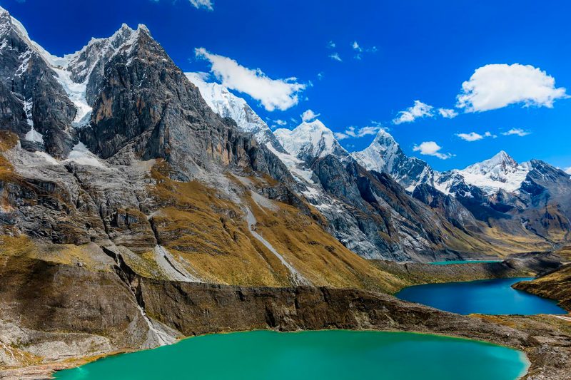
Santa Cruz Trek Details
- Distance: 52 km
- maximum altitude: 4750 m.a.s.l
- Elevation Gain /Loss: +1150 m /-1850 m
- Trek level: Moderate
- Temperature: -6°C / +22°C
- Transportation: Four-day trek supported by donkeys.
Driving Route To / From Santa Cruz Trek
To reach the trailhead, the journey begins along the Huaylas Valley on a paved road that is commonly used for both arriving and returning from the destination. However, the second section transitions into a dirt road, which can make the ride quite bumpy. Additionally, this portion includes winding sections, especially during the ascent and descent near the Portochuelo Pass. As a result, trekkers should be prepared for rougher terrain in this part of the journey.
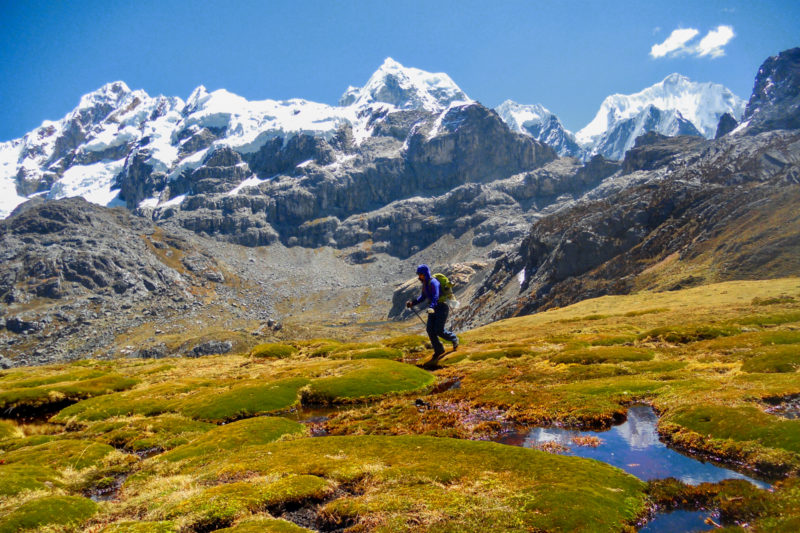
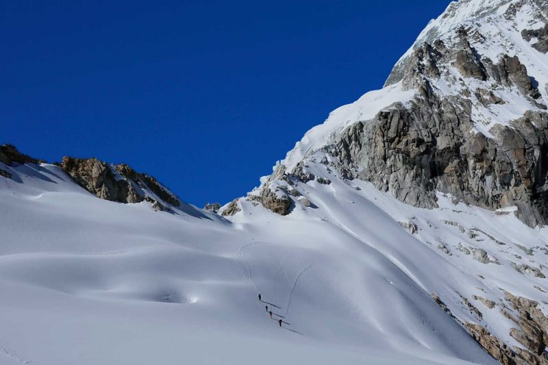
The Trekking trail
The trail features the typical terrain of the Peruvian Andes, offering a diverse trekking experience. Along the way, you’ll walk across old wooden bridges, adding to the authentic Andean adventure. In some areas, the trail can be muddy, especially after rain, while in higher sections, it becomes more rugged and rocky. Additionally, depending on the season, parts of the trail may be covered in snow, particularly at higher elevations. Overall, the trek provides a challenging yet rewarding journey through varied terrain landscapes.
Acclimatization before the trek
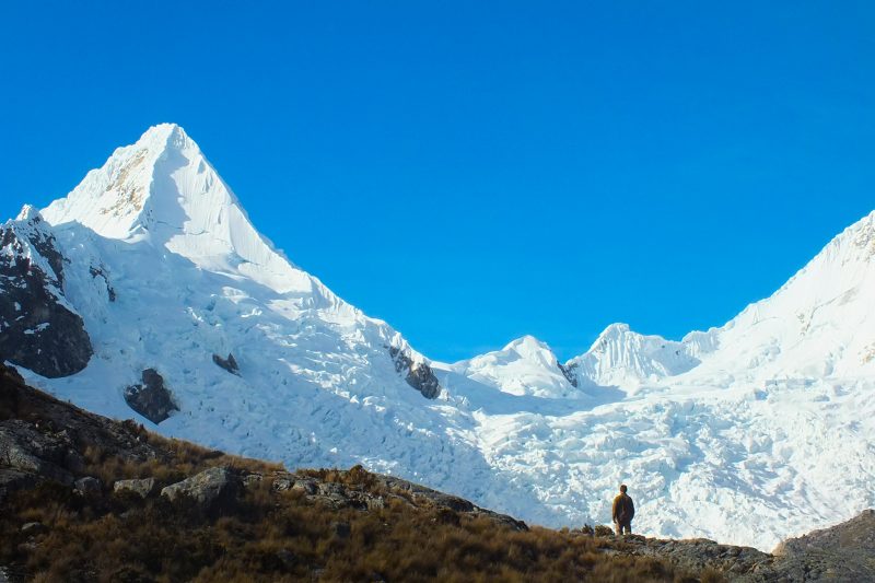
The Santa Cruz Trek is a challenging adventure, particularly recommended for trekkers with prior experience. To successfully complete it, it is essential to be fit and in good physical condition, as you will spend four days at an average altitude of 4,000 meters. Moreover, acclimatization before the trek is crucial! The highest point you’ll reach is the Punta Union Pass, standing at 4,750 meters. If you are coming from sea level or altitudes below 2,500 meters, then it is highly advisable to spend at least 2-3 days in Huaraz accommodations. During this time, you should undertake one to three day hikes to properly adjust to the altitude. Therefore, proper preparation will significantly enhance your experience.
Recommendations for Best Seasons
The trek can be enjoyed year-round; however, the best time to visit is typically from mid-April to late September, or even early October, depending on the year. For nature enthusiasts, April, May, and June offer ideal conditions, with vibrant flowers and lush green landscapes. On the other hand, July and August are perfect for those seeking clear blue skies and are especially favored by photographers, as the warm colors and crisp weather create excellent opportunities for stunning photos. In contrast, from September to April, you’ll experience a mix of sunny and cloudy weather, providing diverse landscapes to explore.
Weather
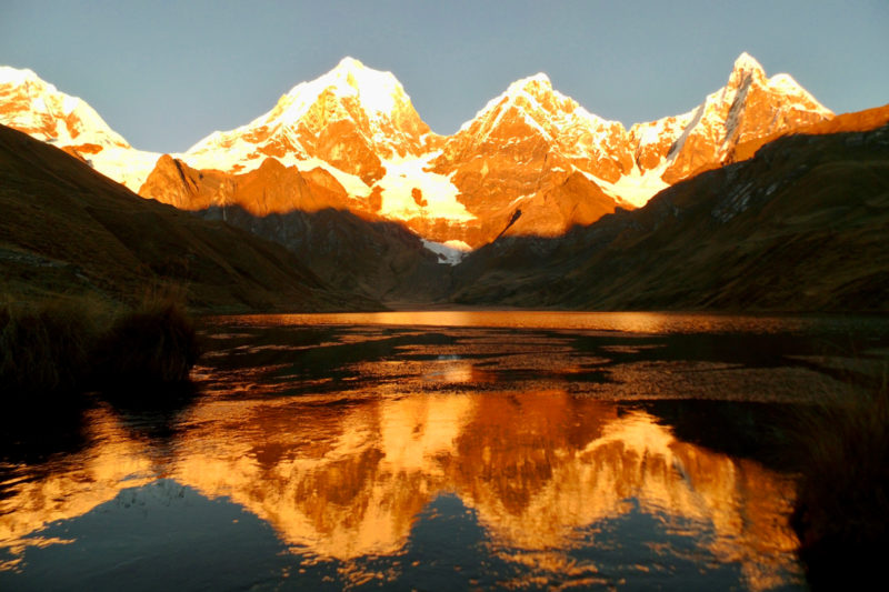
The Santa Cruz Trek and the entire Cordillera Blanca region experience a semi-dry and semi-cold climate. Average temperatures range from a maximum of +26°C during the day to a minimum of -6°C at night. However, it’s important to note that the weather is highly unpredictable. Even though the trek typically occurs during the dry season, rain can still be expected. In addition, temperatures can fluctuate dramatically, from warm during the day to freezing cold at night. Furthermore, over altitudes of 4,800 meters, you may encounter rain, strong winds, or even snow. By early September, cloud cover becomes more frequent. Moreover, October and November are months when you should expect afternoon showers, particularly after 2-3 pm.
- DAY 1
- DAY 2
- DAY 3
- DAY 4
Huaraz 3100m - Vaqueria 3600m- Paria 3800m
*Certainly Santa Cruz trek has 2 option itineraries. The suggested itinerary here is From Vaqueria to Cashapampa, which is provided for information only because it can be modified to adapt to other unexpected events or personal customer preferences.
- Departure: 5:00am, Driving: 4:20h
- Trek time: 4-5 h, Distance: 10km, Elevation Gain /loss: -250m +350m, Grade: Moderate, Campsite: 3800m
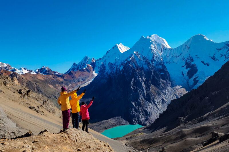
Paria 3800m -Punta Union Pass 4750m-Taullipampa 4250m
Trek time: 8 h, Distance: 12 km, Elevation Gain/loss: +960m -510m , Grade: Dificult, Campsite: 4250m
Taullipampa 4250m- Arhueycocha Lake 4400m- Llamacoral 3750m
Trek time: 7-8 h, Distance: 19 km, Elevation Gain/loss: +200m -700m , Grade: Moderate, Campsite: 3750m
Llamacoral 3750m - Cashapampa 290m - Huaraz 3100m
- Trek time: 4-5 h, Distance: 10km, Elevation loss: -850m, Grade: Easy
- Drive back time: 3:30h, End in Huaraz: 3-4 pm


User Reviews & Comments
Anónimo
octubre 28, 2022